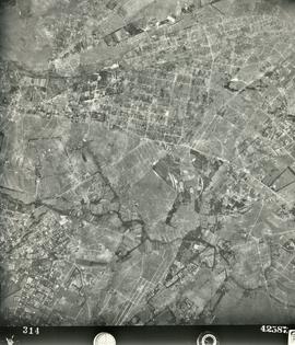
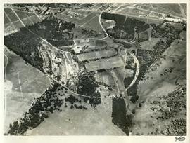
1952 Aerial photograph St Stithians Campus and surrounds 001
- ZA ZAR STS 2022-010-001
- Unidad documental simple
- 1952
Parte deDerek Kyle Fonds
Aerial photograph showing the campus and surrounding farming and peri-urban areas in 1952.
Sin título
1952 Aerial photograph St Stithians Campus and surrounds 001
Parte deDerek Kyle Fonds
Aerial photograph showing the campus and surrounding farming and peri-urban areas in 1952.
Sin título
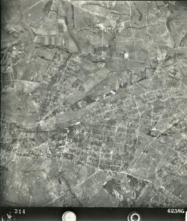
1952 Aerial photograph St Stithians Campus and surrounds 002
Parte deDerek Kyle Fonds
Aerial photograph showing the campus and surrounding farming and peri-urban areas in 1952.
Sin título

1974 21st Anniversary programme: cover
1974 21st Anniversary programme: cover
Sin título
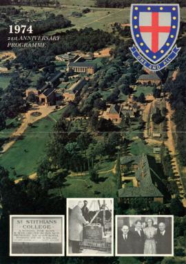
1974 21st Anniversary programme: content
1974 21st Anniversary programme: content
Sin título
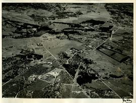
1952 Aerial photographs showing the St Stithians property after the initial earthworks and before the start of construction of the buildings.
Extracts from Derek Kyle's autobiography.
Letter from Mel Wessels accompanying donation.
Sin título
Parte deHarris Fonds
1955 HA 032 Aerial photograph of the College grounds and surrounding areas taken from the north. The intersection of Main Road and the later-named William Nicol Highway can be clearly seen in the central axis of the photograph.
1957 HA 064 Campus aerial view
Parte deHarris Fonds
1957 HA 064 Campus aerial view showing the extent of the College buildings and the ring road and the location of the original school gate close to the centre of Randburg.
Parte deHarris Fonds
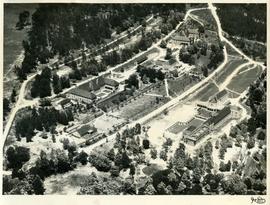
1957 HA 066 BC aerial view showing BC buildings
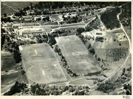
1957 HA 067 Campus aerial view
Parte deHarris Fonds
1957 HA 067 Campus aerial view showing BC buildings and sports facilities, including the swimming bath. The remnants of the orchard from Driefontein farming days are also visible.