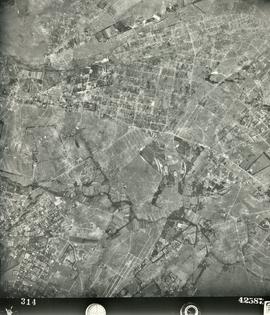
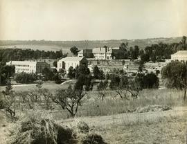
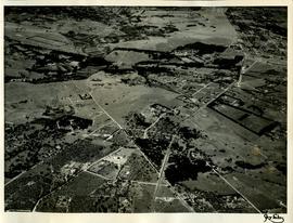
1952 Aerial photograph St Stithians Campus and surrounds 001
- ZA ZAR STS 2022-010-001
- Item
- 1952
Part of Derek Kyle Fonds
Aerial photograph showing the campus and surrounding farming and peri-urban areas in 1952.
Aircraft Operating Company
1952 Aerial photograph St Stithians Campus and surrounds 001
Part of Derek Kyle Fonds
Aerial photograph showing the campus and surrounding farming and peri-urban areas in 1952.
Aircraft Operating Company
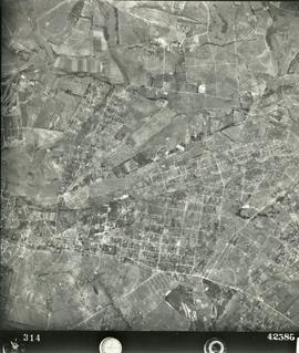
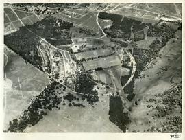
1952 Aerial photograph St Stithians Campus and surrounds 002
Part of Derek Kyle Fonds
Aerial photograph showing the campus and surrounding farming and peri-urban areas in 1952.
Aircraft Operating Company
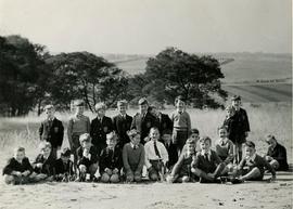
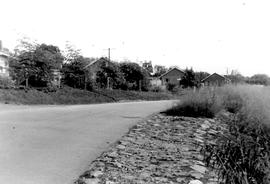
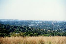
1953 BC Foundation scholars, view looking towards Sandton
Part of Doreen Read Fonds
1953 BC Foundation scholars, view looking across what was later to become the suburb of Parkmore, towards the ridge where Sandton City was built in 1973 on Zandfontein Farm.
This photograph illustrates the remoteness of the St Stithians property at the time the College was founded. The property, itself a portion of the original Driefontein Farm, was surrounded by farmland in 1953.
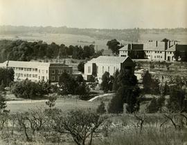
1954 HA 022 BC buildings from orchard
Part of Harris Fonds
1954 HA 022 BC buildings from orchard looking towards Sandton.
Unknown
1954 HA 023 College buildings view to Sandton
Part of Harris Fonds
1954 HA 023 College buildings view to Sandton from orchard
Unknown
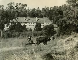
1954 HA 024 BC Mountstephens House with oxen
Part of Harris Fonds
1954 HA 024 BC Mountstephens House with oxen pulling the grass mower.
Unknown
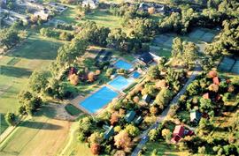
1955 Campus aerial view to South 1955BC_0003
Part of Boys' College and Boys' Prep photographs 1953 onwards
1995 First Aerial view of Campus in the Bryanston context. Many landmarks are recognisable in this photograph e.g. the Mount St Water tower; the Braamfontein Spruit and the intersection of Main Road and William Nicol before the establishment of the highway.
Unknown
1955 Campus view from koppie 1955BC_0002
Part of Boys' College and Boys' Prep photographs 1953 onwards
1995 Campus view
Unknown
Part of Harris Fonds
1955 HA 032 Aerial photograph of the College grounds and surrounding areas taken from the north. The intersection of Main Road and the later-named William Nicol Highway can be clearly seen in the central axis of the photograph.
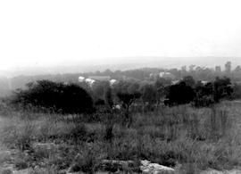
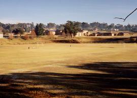
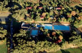
1957 Campus view from koppie area 001 1957BC_0012
Part of Boys' College and Boys' Prep photographs 1953 onwards
1957 Campus view from koppie area 001
Unknown
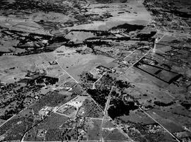
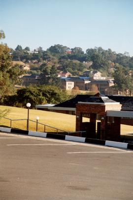
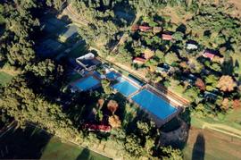
1957 HA 064 Campus aerial view
Part of Harris Fonds
1957 HA 064 Campus aerial view showing the extent of the College buildings and the ring road and the location of the original school gate close to the centre of Randburg.
Part of Harris Fonds
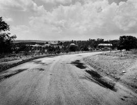
1961 HA 094 Corlett Gate viewed from the north
1964 BC staff houses above pool circa 1964
Part of Boys' College and Boys' Prep photographs 1953 onwards
1964 BC staff houses above pool at the top of Chapel Drive. Photograph dated to circa 1964.
Boys' College
1964 Campus view from koppie area c.1964 NIS
Part of Boys' College and Boys' Prep photographs 1953 onwards
1964 Campus view from koppie area circa 1964 NIS.
Boys' College
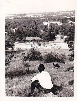
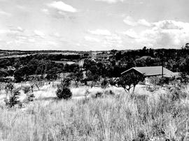
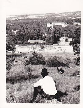
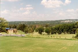
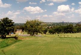
1965 BC view over BC to Sandton from the Koppie
Part of Boys' College and Boys' Prep photographs 1953 onwards
Landscape view showing the extent of the campus with the view to Sandton from the Koppie.
Boys' College
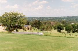
1965 Campus view to BC and Sandton
Part of Douglas Drysdale Fonds
1965 Campus view to BC and Sandton. The staff house closest to the squash courts can be seen under construction.
Drysdale, Douglas
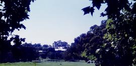
1967 BC Chapel lawns Badminton Court NIS TBI
Part of Boys' College and Boys' Prep photographs 1953 onwards
Badminton Court on BC Cheetah slopes close to Tennis courts. NIS TBI. Date is estimated to be circa 1967.
Boys' College
1969 BC Presentation of cattle Henning collection
Part of Boys' College and Boys' Prep photographs 1953 onwards
1969 BC Presentation of cattle Henning collection. The presenter, [...] was a local policeman who grazed his cattle on the school property in return for their use to pull the grass cutter. In this photograph he presents the College with an ox.
Legend:
Mark Henning, [...], Ray Bradley, Vernon Clegg, Lindsay Baytopp
Boys' College
Part of Boys' College and Boys' Prep photographs 1953 onwards
1976 BC Chapel drive viewed from the Chapel
Boys' College
Part of Boys' College and Boys' Prep photographs 1953 onwards
1976 BC Chapel drive to west
Boys' College
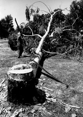
1979 BP Grades 6 & 7 Block removing blue gums ST p110
Part of Boys' College and Boys' Prep photographs 1953 onwards
1979 BP Grades 6 & 7 Block removing blue gums ST p110
Front row:
Back row:
Boys' College
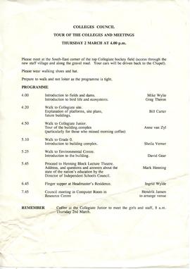
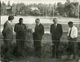
1995 GC Council Tour Programme 001
Part of Girls' College and Girls' Prep photographs 1994 onwards
1995 GC Council Tour Programme
The Council visit to the Collegiate building site and the JP Collegiate.
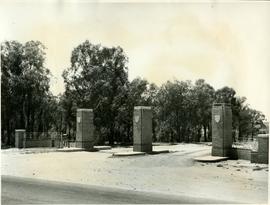
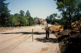
1995 GC Peter Place Gate construction 001
Part of Girls' College and Girls' Prep photographs 1994 onwards
1995 GC Peter Place Gate construction 001
The gate was constructed at the same time as the Collegiate in order to accommodate the extra traffic.
1995 GC Peter Place Gate construction 002
Part of Girls' College and Girls' Prep photographs 1994 onwards
1995 GC Peter Place Gate construction 002
The gate was constructed at the same time as the Collegiate in order to accommodate the extra traffic.
1995 GC Peter Place Gate construction 003
Part of Girls' College and Girls' Prep photographs 1994 onwards
1995 GC Peter Place Gate construction 003
The gate was constructed at the same time as the Collegiate in order to accommodate the extra traffic.
1995 GC Peter Place Gate construction 004
Part of Girls' College and Girls' Prep photographs 1994 onwards
1995 GC Peter Place Gate construction 004
The gate was constructed at the same time as the Collegiate in order to accommodate the extra traffic.
1995 GC Peter Place Gate construction 005
Part of Girls' College and Girls' Prep photographs 1994 onwards
1995 GC Peter Place Gate construction 005
The gate was constructed at the same time as the Collegiate in order to accommodate the extra traffic.
1995 GC Peter Place Gate construction 005
Part of Girls' College and Girls' Prep photographs 1994 onwards
1995 GC Peter Place Gate construction 005
The gate was constructed at the same time as the Collegiate in order to accommodate the extra traffic.
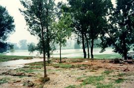
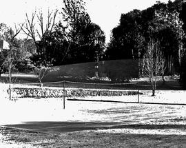
1996 GC Landscapes Heavy rains 001
Part of Girls' College and Girls' Prep photographs 1994 onwards
1996 GC Landscapes Heavy rains 001
Girls' College
1996 GC Landscapes Heavy rains 002
Part of Girls' College and Girls' Prep photographs 1994 onwards
1996 GC Landscapes Heavy rains 002
Girls' College
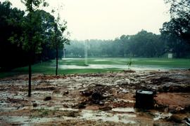
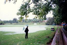
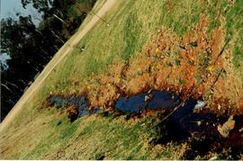
1996 GC Landscapes Heavy rains 003
Part of Girls' College and Girls' Prep photographs 1994 onwards
1996 GC Landscapes Heavy rains 003
1996 Landscapes GC in summer viewed across Baytopp field under water from heavy rains.
Girls' College
1996 GC Landscapes Heavy rains 004
Part of Girls' College and Girls' Prep photographs 1994 onwards
1996 Landscapes GC in summer viewed across Baytopp field under water from heavy rains.
1996 GC Landscapes Heavy rains 004
Girls' College
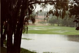
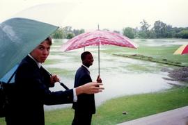
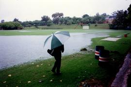
1996 GC Landscapes Heavy rains 053
Part of Girls' College and Girls' Prep photographs 1994 onwards
1996 GC Landscapes Heavy rains 053
1996 Landscapes BC in summer viewed across Baytopp field under water from heavy rains.
Girls' College
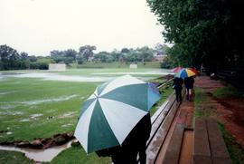
1996 GC Landscapes Heavy rains 054
Part of Girls' College and Girls' Prep photographs 1994 onwards
1996 GC Landscapes Heavy rains 054
1996 Landscapes BC in summer viewed across Baytopp field under water from heavy rains.
Girls' College
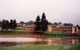
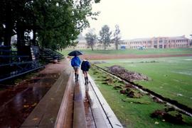
1996 GC Landscapes Heavy rains 055
Part of Girls' College and Girls' Prep photographs 1994 onwards
1996 GC Landscapes Heavy rains 055
1996 Landscapes GC in summer viewed across Baytopp field under water from heavy rains.
Girls' College
1996 GC Landscapes Heavy rains 056
Part of Girls' College and Girls' Prep photographs 1994 onwards
1996 GC Landscapes Heavy rains 056
1996 Landscapes GC in summer viewed across Baytopp field under water from heavy rains.
Girls' College
1996 GC Landscapes Heavy rains 057
Part of Girls' College and Girls' Prep photographs 1994 onwards
1996 GC Landscapes Heavy rains 057
1996 Landscapes BC in summer viewed across Baytopp field under water from heavy rains.
Girls' College
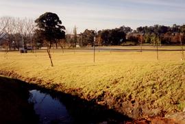
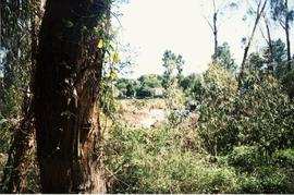
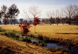
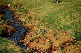
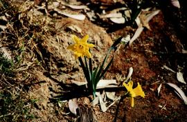
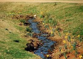
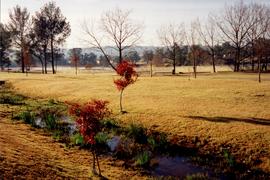
1996 GC Landscapes Stream in autumn 012
Part of Girls' College and Girls' Prep photographs 1994 onwards
1996 GC Landscapes Stream in autumn 012
Girls' College
1996 GC Landscapes View from GC 006
Part of Girls' College and Girls' Prep photographs 1994 onwards
1996 GC Landscapes View from GC 006
Girls' College
1996 GC Landscapes View from GC 014
Part of Girls' College and Girls' Prep photographs 1994 onwards
1996 GC Landscapes Heavy rains 004
Girls' College
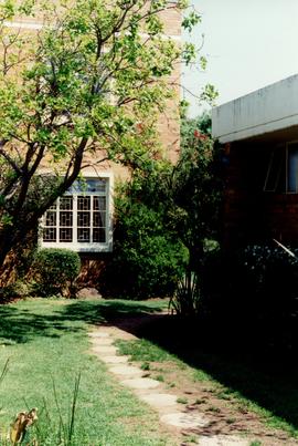
1997 BC Henning block gardens 001
Part of Boys' College and Boys' Prep photographs 1953 onwards
1997 BC Henning block gardens 001
Boys' College
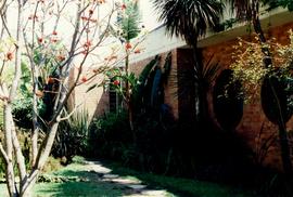
1997 BC Henning block gardens 002
Part of Boys' College and Boys' Prep photographs 1953 onwards
1997 BC Henning block gardens 002
Boys' College
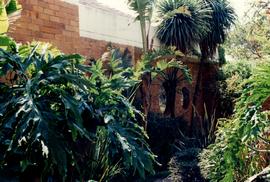
1997 BC Henning block gardens 003
Part of Boys' College and Boys' Prep photographs 1953 onwards
1997 BC Henning block gardens 003
Boys' College
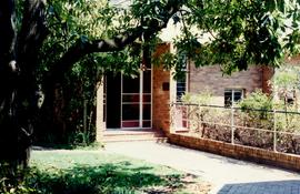
1997 BC Henning block gardens 004
Part of Boys' College and Boys' Prep photographs 1953 onwards
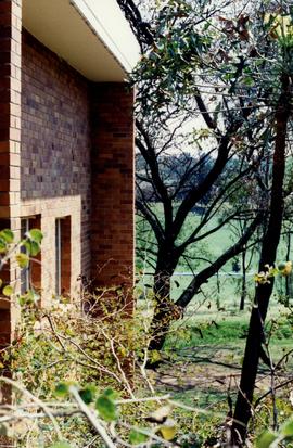
1997 BC Henning block gardens 004 showing the original east entrance to the block, later closed off when the building's use changed form VIth Form to Finance Dept.
Boys' College
1997 BC Henning block gardens 005
Part of Boys' College and Boys' Prep photographs 1953 onwards
1997 BC Henning block gardens 004 showing the view from the original entrance to the Henning block northwards to the fields. The steps down to the BC Computer labs and the exterior entrance to the HBLT were added at a later stage.
Boys' College
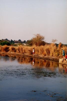
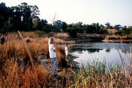
1997 BP Landscapes Fishing at the dam 015
Part of Girls' College and Girls' Prep photographs 1994 onwards
1997 BP Landscapes Fishing at the dam 015
Girls' College
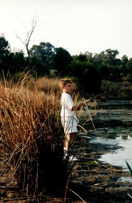
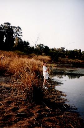
1997 BP Landscapes Fishing at the dam 067
Part of Girls' College and Girls' Prep photographs 1994 onwards
1997 BP Landscapes Fishing at the dam 067
Girls' College
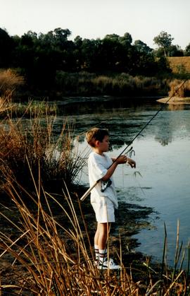
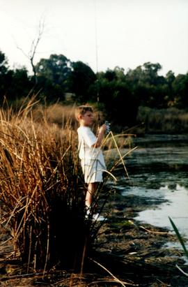
1997 BP Landscapes Fishing at the dam 069
Part of Girls' College and Girls' Prep photographs 1994 onwards
1997 BP Landscapes Fishing at the dam 069
Girls' College
1997 BP Landscapes Fishing at the dam 070
Part of Girls' College and Girls' Prep photographs 1994 onwards
1997 BP Landscapes Fishing at the dam 070
Girls' College
1997 BP Landscapes Fishing at the dam 071
Part of Girls' College and Girls' Prep photographs 1994 onwards
1997 BP Landscapes Fishing at the dam 071
Girls' College
1997 BP Landscapes Fishing at the dam 073
Part of Girls' College and Girls' Prep photographs 1994 onwards
1997 BP Landscapes Fishing at the dam 073
Girls' College
1997 BP Landscapes Fishing at the dam 074
Part of Girls' College and Girls' Prep photographs 1994 onwards
1997 BP Landscapes Fishing at the dam 074
Girls' College
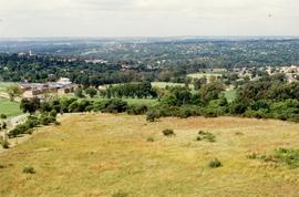
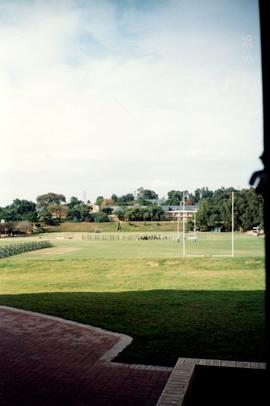
Part of Boys' College and Boys' Prep photographs 1953 onwards
1997 Campus landscape 001: view towards Sandton from Koppie
Boys' College
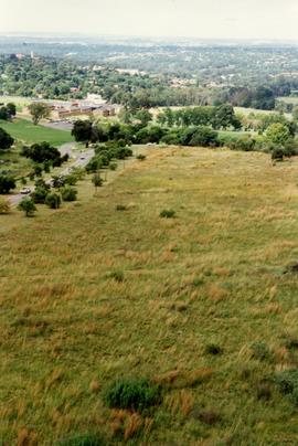
Part of Boys' College and Boys' Prep photographs 1953 onwards
1997 Campus landscape 001: view over GC and GP from Koppie
Boys' College
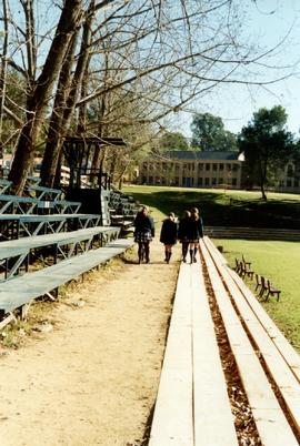
1997 GC Landscapes Long walk to Chapel 002
Part of Girls' College and Girls' Prep photographs 1994 onwards
1997 Landscapes GC girls take the long walk to Chapel across Baytopp field
1997 GC Landscapes Long walk to Chapel 002
Girls' College
1997 GC Landscapes GC from Nestle House 052
Part of Girls' College and Girls' Prep photographs 1994 onwards
1997 GC Landscapes GC from Nestle House 051
Girls' College
1997 GC Landscapes GC in winter from Ridgway field 016
Part of Girls' College and Girls' Prep photographs 1994 onwards
1997 GC Landscapes GC in winter from Ridgway field 016
Girls' College
1997 GC Landscapes Long walk to Chapel 003
Part of Girls' College and Girls' Prep photographs 1994 onwards
1997 GC Landscapes Long walk to Chapel 003
Girls' College
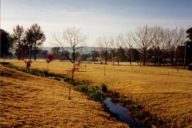
1997 GC Landscapes Stream in autumn 017
Part of Girls' College and Girls' Prep photographs 1994 onwards
1997 GC Landscapes Stream in autumn 017
Girls' College
1997 GC Landscapes Stream in autumn 018
Part of Girls' College and Girls' Prep photographs 1994 onwards
1997 GC Landscapes Stream in autumn 018
Girls' College
1997 GC Landscapes Stream in Spring 033
Part of Girls' College and Girls' Prep photographs 1994 onwards
1997 GC Landscapes Stream in Spring 033
Girls' College
1997 GC Landscapes Stream in Spring 034
Part of Girls' College and Girls' Prep photographs 1994 onwards
1997 GC Landscapes Stream in Spring 034
Girls' College
1997 GC Landscapes Stream in Spring 035
Part of Girls' College and Girls' Prep photographs 1994 onwards
1997 GC Landscapes Stream in Spring 035
Girls' College
1997 GC Landscapes View from the GC parking 030
Part of Girls' College and Girls' Prep photographs 1994 onwards
1997 GC Landscapes View from the GC parking 030
Girls' College
1997 JP Landscapes Entrance to JP 019
Part of Girls' College and Girls' Prep photographs 1994 onwards
1997 JP Landscapes Entrance to JP 019
Girls' College
1997 Landscapes GC Stream in Spring 032
Part of Girls' College and Girls' Prep photographs 1994 onwards
1997 Landscapes GC Stream in Spring 032
Girls' College
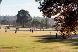
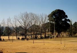
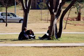
1998 BC Landscapes Playing on Baytopp Field 022
Part of Girls' College and Girls' Prep photographs 1994 onwards
1998 BC Landscapes Playing on Baytopp Field 022
Girls' College
1998 BC Landscapes Playing on Baytopp Field 031
Part of Girls' College and Girls' Prep photographs 1994 onwards
1998 BC Landscapes Playing on Baytopp Field 031
Girls' College
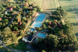
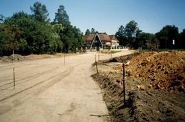
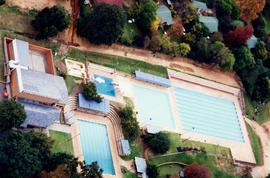
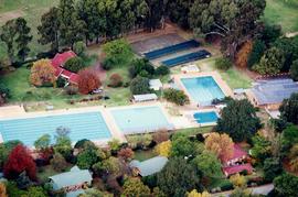
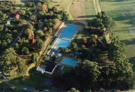
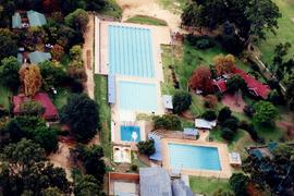
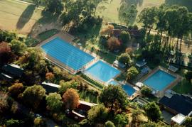
1998 Campus Landscapes - Aquatics Complex 001
Part of Girls' College and Girls' Prep photographs 1994 onwards
1998 Campus Landscapes - Aquatics Complex 001
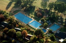
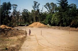
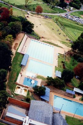
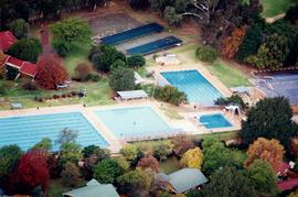
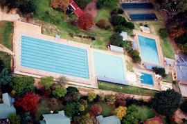
1998 Campus Landscapes - Aquatics Complex 002
Part of Girls' College and Girls' Prep photographs 1994 onwards
1999 Campus Landscapes - Aquatics Complex 002
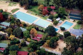
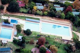
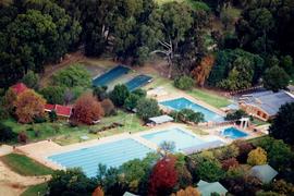
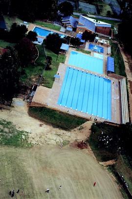
1998 Campus Landscapes - Aquatics Complex 003
Part of Girls' College and Girls' Prep photographs 1994 onwards
1998 Campus Landscapes - Aquatics Complex 003
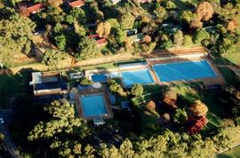
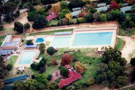
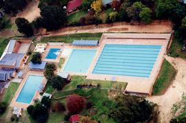
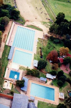
1998 Campus Landscapes - Aquatics Complex 004
Part of Girls' College and Girls' Prep photographs 1994 onwards
1998 Campus Landscapes - Aquatics Complex 004
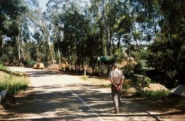
Part of Girls' College and Girls' Prep photographs 1994 onwards
1998 Campus landscapes 001
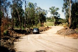
Part of Girls' College and Girls' Prep photographs 1994 onwards
1998 Campus landscapes 002
Part of Girls' College and Girls' Prep photographs 1994 onwards
1998 Campus landscapes 003
Part of Girls' College and Girls' Prep photographs 1994 onwards
1998 Campus landscapes 004
Part of Girls' College and Girls' Prep photographs 1994 onwards
1998 Campus landscapes 005
Part of Girls' College and Girls' Prep photographs 1994 onwards
1998 Campus landscapes 006
Part of Girls' College and Girls' Prep photographs 1994 onwards
1998 Campus landscapes 007
Part of Girls' College and Girls' Prep photographs 1994 onwards
1998 Campus landscapes 008
Part of Girls' College and Girls' Prep photographs 1994 onwards
1998 Campus Landscapes 009
Part of Girls' College and Girls' Prep photographs 1994 onwards
1998 Campus landscapes 009
Part of Girls' College and Girls' Prep photographs 1994 onwards
1998 Campus landscapes 010
Part of Girls' College and Girls' Prep photographs 1994 onwards
1998 Campus landscapes 011
Part of Girls' College and Girls' Prep photographs 1994 onwards
1998 Campus landscapes 012
Part of Girls' College and Girls' Prep photographs 1994 onwards
1998 Campus landscapes 013
Part of Girls' College and Girls' Prep photographs 1994 onwards
1998 Campus landscapes 014
Part of Girls' College and Girls' Prep photographs 1994 onwards
1998 Campus landscapes 015
Part of Girls' College and Girls' Prep photographs 1994 onwards
1998 Campus landscapes 016
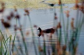
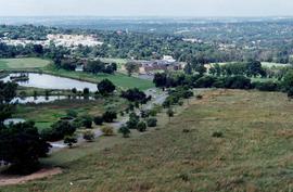
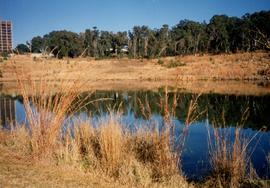
1998 GC Landscapes Bird life on the dam 025
Part of Girls' College and Girls' Prep photographs 1994 onwards
1998 GC Landscapes Bird life on the dam 025
Girls' College
1998 GC Landscapes Long walk to Chapel 003
Part of Girls' College and Girls' Prep photographs 1994 onwards
1998 GC Landscapes Long walk to Chapel 003
Girls' College
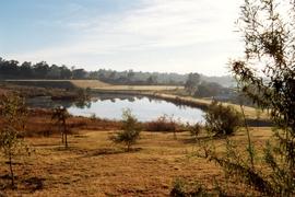
1998 GC Landscapes New dam 026
Part of Girls' College and Girls' Prep photographs 1994 onwards
1998 GC Landscapes New dam 026
Girls' College
1998 GC Landscapes Resting under the trees 023
Part of Girls' College and Girls' Prep photographs 1994 onwards
1998 GC Landscapes Resting under the trees 023
Girls' College
1998 GC Landscapes Stream in autumn 027
Part of Girls' College and Girls' Prep photographs 1994 onwards
1998 GC Landscapes Stream in autumn 027
Girls' College
1998 GC Landscapes View from dam to GC 020
Part of Girls' College and Girls' Prep photographs 1994 onwards
1998 GC Landscapes View from dam to GC 020
Girls' College
1998 GC Landscapes View from dam to GC 021
Part of Girls' College and Girls' Prep photographs 1994 onwards
1998 GC Landscapes View from dam to GC 021
Girls' College
1998 GC Landscapes View from dam to Nestle House 026
Part of Girls' College and Girls' Prep photographs 1994 onwards
1998 GC Landscapes View from dam to Nestle House 026
Girls' College
1998 GC Landscapes View from dam wall to GC 027
Part of Girls' College and Girls' Prep photographs 1994 onwards
1998 GC Landscapes View from dam wall to GC 027
Girls' College
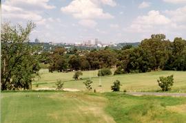
1998 GC Landscapes View from Nestle House to Sandton 030
Part of Girls' College and Girls' Prep photographs 1994 onwards
1998 GC Landscapes View from Nestle House to Sandton 030
Girls' College
1998 GC Landscapes View from the GC 029
Part of Girls' College and Girls' Prep photographs 1994 onwards
1998 GC Landscapes View from the GC 029
Girls' College